OK, not exactly 8,000 years old; only 7,800 years old. That’s when Mount Mazama erupted. It was a huge eruption, much larger than anything we know of except Mount Tambura in 1815. Mt. St. Helens in 1981 ejected only about 1 cubic kilometer of material; Mt. Pinatubo in 1991 ejected 10 cubic kilometers. Krakatoa ejected 18 cubic kilometers. Mount Mazama ejected 100 cubic kilometers, while Tambura ejected 150 cubic kilometers. So yes, the eruption of Mt. Mazama was a big deal. The ash from that eruption was up to 2 inches thick over much of Washington state, Idaho, and parts of Montana and British Columbia. It was 12 inches thick over much of Oregon, and close by the mountain, it was twenty or even thirty feet deep.
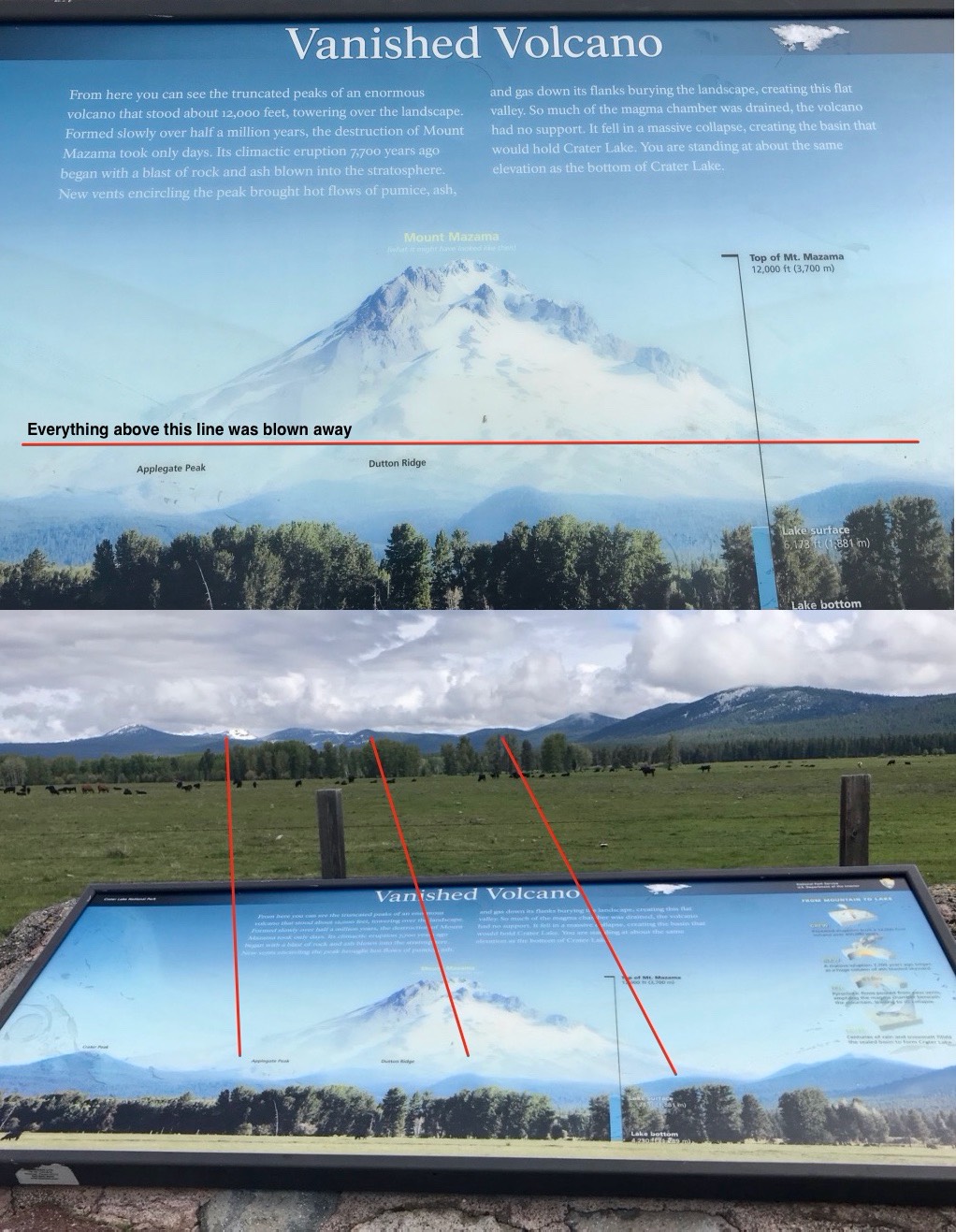
Here are two pictures giving you an idea of what Mount Mazama looked like before the eruption. The first picture shows what it would have looked like from that location; the one on the right shows the relationship between the modern features and what Mount Mazama looked liked back then. The comparison should give you an idea of how much of the volcano disappeared. Note especially the blue marker in the lower right that shows the current surface of Crater Lake in what’s left of the volcano.

I found the log on the banks of Lemolo Lake; here’s an image from Google Maps showing the distance between Lemolo Lake and Crater Lake:
Yes, that’s the base of Mount Mazama at the bottom. Crater Lake itself is about five miles in diameter.
Here’s the incense cedar log sticking out from a bank of volcanic ash about twenty feet deep:
Here’s a closer look:
Unburnt wood is underneath it:
Here’s the strange thing: this wood is unburnt, but the wood beneath the log has been reduced to charcoal and the outer portion of the log is also charred. So why wasn’t this log burned? My guess is that the hot ash set fire to all the standing trees, but this one was buried in ash after the outer layers had been burnt, and deep inside the ash, there wasn’t any oxygen left to permit combustion.
